What’s up everybody, this here is a recap of an Easter day adventure that involves steep trails, a ridge route, one bagged peak and even a trail run!
I met up with Andrew T. at Bailey Canyon Wilderness Park on a nice cool Easter morning at 6:30am for a hike up Bailey Canyon up to Jones saddle, from there we would take the ridge up and over Hastings peak all of the way to the Mt. Wilson Toll Road where we would take it to where the Mt. Wilson Trail meets it. From there we put on our trail running hats and ran the 6 miles back to Sierra Madre. A short walk on the streets would take us back to the starting point.
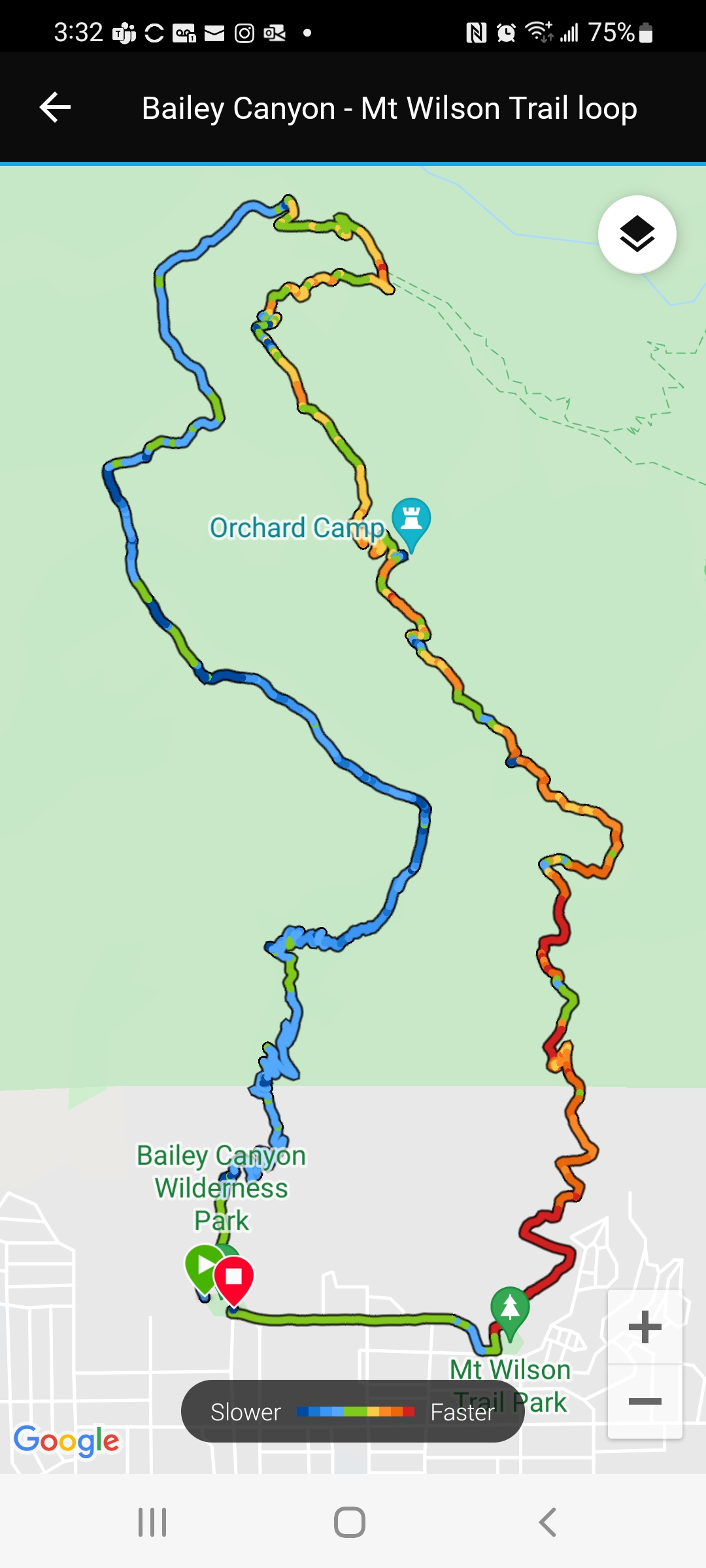 The first part of this hike goes up the Bailey Canyon trail to Jones Saddle, This is a very steep 3 mile trail with a lot of switch backs, a lot steeper than many of the local hikes in the area which makes it a very good workout hike. There is a flat spot around mile 2 where there are some ruins of a cabin which is a good spot to take a break for the last climb to the Saddle.
Above Jones Peak on ridge
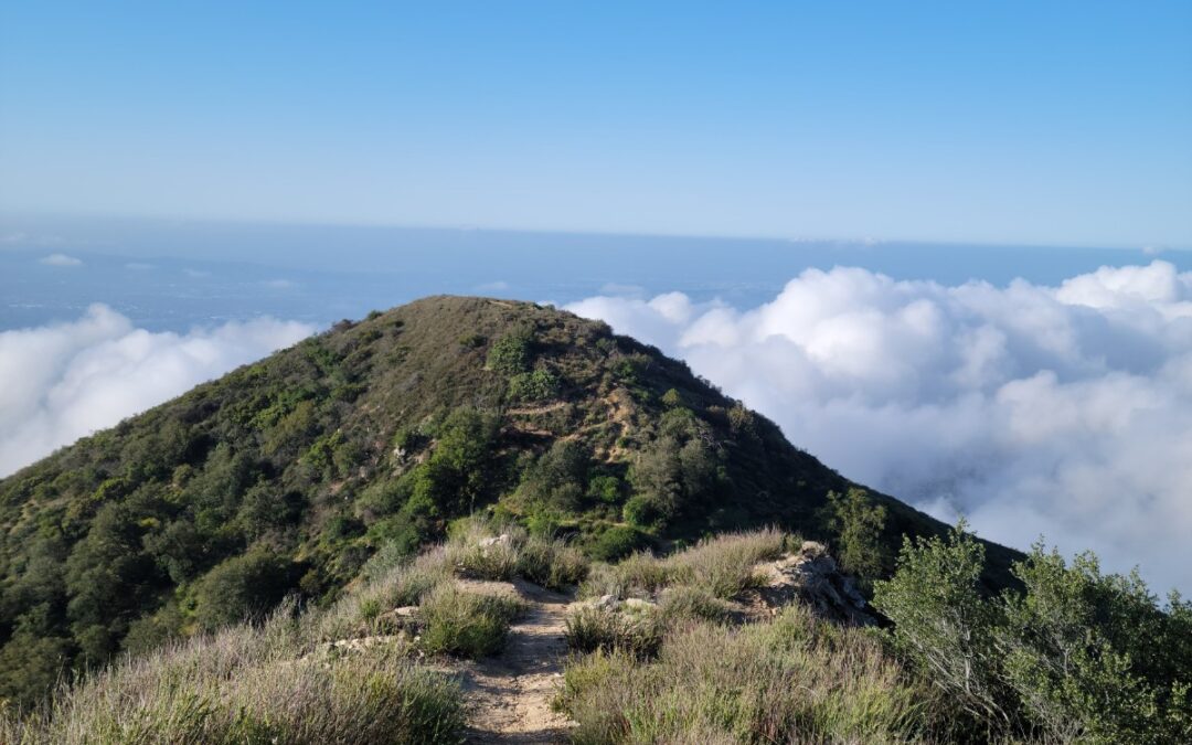
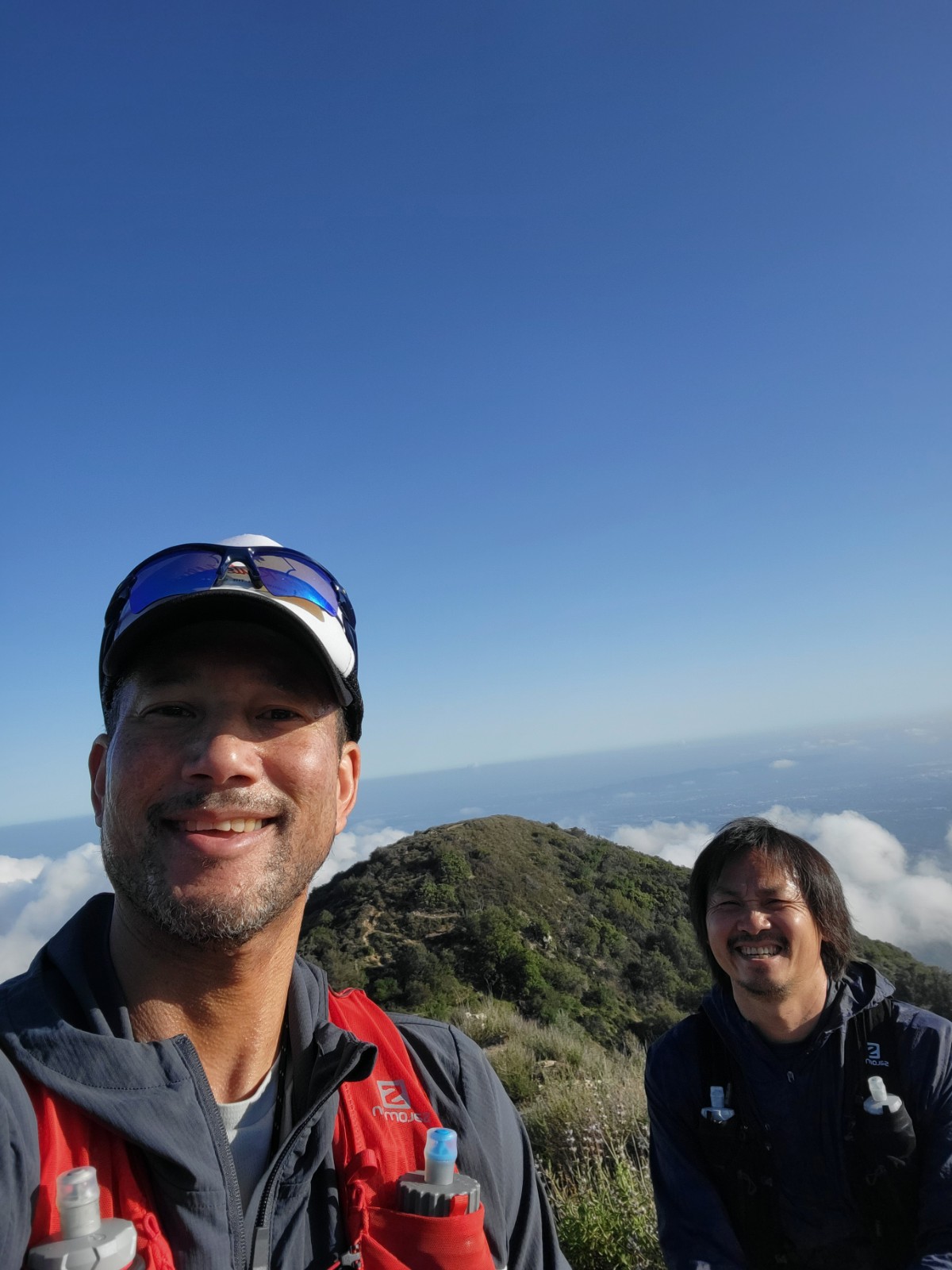
Once we got to the Saddle, we skipped the side trip to Jones Peak and went straight up the ridge. The ridge route has signs and looks to be taken good care of as the trail was clear and easy to follow. There is even a sign letting us know that it was 1.5 miles to the toll road. About a quarter mile up from Jones Saddle is an intersection with a trail that drops down to the Mt. Wilson trail, but we kept going up. About halfway up the ridge we made it to Hastings Peak which has a nice bench to take a break on, there is also a surveyor marker and a pole to mark the peak. While we were taking a break another hiker came up and by coincidence, she was wearing the exact same old race shirt as I was so I called out to her telling her that she was my twin, LOL. We took a picture to mark the occasion and talked about running since all of us had old race shirts on. Her name was Teresa and she was going to continue on the ridge all of the way to Mt. Harvard and then to Mt. Wilson.
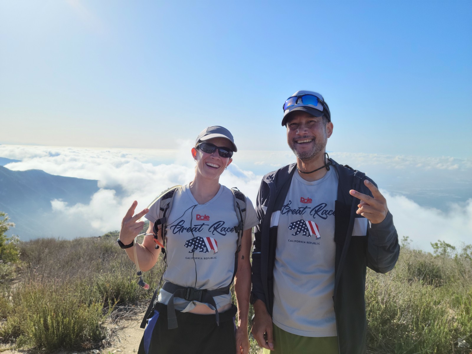
Hiking Twin Teresa
After the break we continued up the ridge past one more mountain and then the last couple of hundred yards to the toll road, the last 50 feet or so was basically a scramble up a sheer dirt wall and not a trail at all but there were foot holds kicked in like you would see on a snow hike and even a cable to help you up if needed. From the car to the Toll Road was about 4.5 miles. From there we followed the toll road for 1.5 miles that seemed longer until we got to the intersection of the Mt. Wilson Trail.
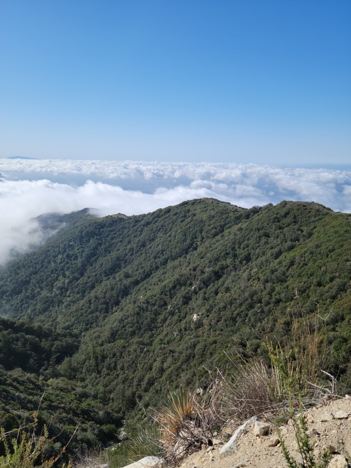
View from Mt Wilson Toll Rd.
Once on the Mt Wilson Trail we ran down the whole way stopping for a minute at Orchard Camp for a snack and then all the way down to Sierra Madre. Once we got back to the city, we still had to get back to our cars so we hiked it over back to Bailey Canyon Wilderness park. Thankfully it was only about ½ of a mile. Total for the hike/run was 12.4 miles per my watch and took us about 4 Hours, 40 minutes.

This was a nice loop that is easy to do solo or with friends (who don’t mind a workout!), at least in the spring before it gets to hot anyways. Hope you enjoyed this hike report and maybe you can go try this one for yourself!
See ya!
Simply put beautiful. Thanks for sharing your well documented Easter hike/run.
Thanks Justin
Nice walk in the park. Great report make’s me want to get out there.